
If you rely on your phone for backcountry navigation, you’re one dead battery or lost signal away from a genuine emergency. The term “backcountry navigation kit” gets thrown around casually, but after a string of high-profile rescues tied directly to hikers following Google Maps into wilderness dead zones — including cases where GPS routing sent people down unmaintained fire roads, across private land, and into terrain with no trail whatsoever — it’s time to talk seriously about what a real navigation system looks like. Your phone will fail you. The question is whether you’ll be prepared when it does.
Google Maps is an extraordinary urban tool. It is not a wilderness navigation system. It has no concept of trail conditions, seasonal closures, canyon walls, or the fact that the “road” it’s routing you down hasn’t been maintained since the 1980s. Search and rescue teams across the American West have reported a measurable uptick in calls from hikers who trusted consumer mapping apps into terrain those apps were never designed to handle. This isn’t a knock on technology — it’s a recognition that the right technology matters enormously out there.
This guide walks you through a complete, layered navigation kit: dedicated GPS hardware, offline-capable apps actually built for trail use, and the analog backups that will get you home when everything else fails. We’ve tested these tools on trails in the Cascades, the Sierra Nevada, and the Colorado Rockies — places where cell service is a memory from the trailhead parking lot onward.
Why Your Smartphone Is a Liability in the Backcountry
Modern smartphones have decent GPS chips, but they’re engineered around the assumption of cell connectivity. Triangulation accuracy drops in deep canyons. Battery life craters when the device is constantly hunting for a signal it can’t find. Cold temperatures — anything below 40°F — dramatically reduce lithium-ion battery performance, and your phone can go from 40% charge to dead in under an hour in genuine alpine conditions. The hardware is simply not designed for what you’re asking it to do.
Beyond battery and signal, the software problem is just as serious. Google Maps downloads are region-based, not trail-based. You might get road data offline, but detailed topographic overlays, trail-specific routing, and waypoint management don’t exist natively in consumer apps. Even when people think they’ve downloaded “offline maps,” they’re often looking at road-layer data with no meaningful trail information. We’ve tested this repeatedly — see our detailed head-to-head in the Backcountry Navigation App Tested: Google Maps vs. Gaia GPS vs. Garmin on the Same Trail breakdown for exactly how badly consumer apps perform once you’re a mile past pavement.
The fix is not to abandon your phone — it’s to stop treating your phone as your primary navigation device. Use it as a backup. Build your kit around tools designed for the job.

Dedicated GPS Devices: The Backbone of Your Backcountry Navigation Kit
A purpose-built GPS unit changes the game. These devices use satellite positioning independent of cell towers, carry their own topographic maps, run on AA batteries or massive internal cells rated for days of use, and are built to survive drops, rain, and cold. They’re not sexy. They’re reliable — which matters a lot more at mile 14 when the clouds roll in.
For most backcountry hikers, the choice comes down to Garmin’s inReach and GPSMAP lines. The inReach series adds two-way satellite messaging on top of navigation, which makes it a hybrid safety and navigation device. The GPSMAP units are pure navigation workhorses with preloaded topo maps and exceptional battery life. Both families are worth serious consideration, and your choice should depend on whether communication capability is a priority for your trip profile. Solo hikers in serious terrain should strongly consider the inReach for its SOS functionality alone.
1. Garmin inReach Mini 2 🛰️
The inReach Mini 2 is the lightest dedicated satellite communicator and GPS unit Garmin makes, weighing just 3.5 oz. It pairs with your phone via the Garmin Explore app for detailed mapping while providing standalone SOS, two-way messaging, and weather forecasts via Iridium satellite network — completely independent of cell service. Battery life runs up to 14 days in tracking mode. This is our top recommendation for solo hikers and anyone venturing into serious backcountry terrain.
Pros:
- ✅ True satellite communication with SOS, no cell required
- ✅ Ultralight at 3.5 oz — barely noticeable in a hip belt pocket
- ✅ 14-day battery in tracking mode
Cons:
- ⚠️ Requires a monthly satellite subscription plan
- ⚠️ Small screen — better used paired with phone app for detailed map reading
2. Garmin GPSMAP 67i 🗺️
If you want a standalone GPS unit with a full-size screen, preloaded TopoActive maps, and inReach satellite communication built in, the GPSMAP 67i is the most complete single-device solution on the market. The 3-inch sunlight-readable display is genuinely usable in bright alpine conditions. It runs on two AA batteries — which means field-replaceable power anywhere on earth — and delivers up to 165 hours of battery life in standard GPS mode. This is the unit we reach for on extended routes and technical navigation terrain.
Pros:
- ✅ Large readable screen with preloaded topo maps
- ✅ AA batteries — replaceable anywhere, no charging required
- ✅ Full inReach satellite communication and SOS built in
Cons:
- ⚠️ Premium price point — one of the more expensive units available
- ⚠️ Heavier than the Mini 2 at 8.1 oz
The Best Offline Navigation Apps (Built for Trails, Not Roads)
Your phone should be your secondary navigation layer, not your primary — but with the right app and proper preparation, it’s a genuinely useful backup. The key distinction is choosing apps designed specifically for trail navigation with robust offline map packages. Gaia GPS is the category leader: it supports downloadable topo layers from USGS, National Geographic Trails Illustrated, and satellite imagery, all usable without any cell connection. The trail database is extensive, route planning is intuitive, and the offline packages are actually comprehensive rather than a stripped-down road layer pretending to be trail data.
CalTopo is the serious mapper’s choice, particularly if you’re doing route planning before a trip and want the best USGS topo data available. It’s more technical than Gaia but extremely powerful for custom route creation. onX Backcountry has made significant inroads with hunters and hikers alike, and its offline packages are solid. Whichever app you choose, the critical step — the one most people skip — is downloading your maps before you leave cell service. Open the app, navigate to your area, download the offline package, and verify it loads without a data connection. Do this at home. Do not assume it will work in the parking lot.
For a detailed comparison of how these apps perform against each other and against consumer mapping tools on actual trail conditions, check our review of Phone GPS vs. Dedicated GPS: 3 Devices Tested in Dead Zones — the results are more nuanced than you might expect.

Analog Backup: Map and Compass Skills That Actually Save Lives
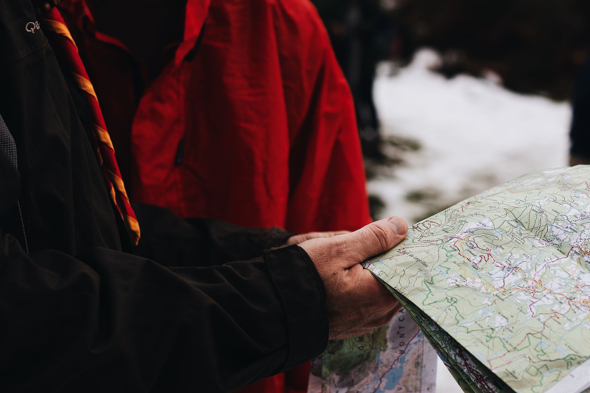
Every piece of electronic navigation gear you carry can fail. Batteries die, screens crack, devices get dropped in creek crossings. The analog backup is not optional — it is the final layer that keeps you from being genuinely lost. A printed USGS 7.5-minute topographic map for your specific area costs a few dollars from a ranger station or print shop. A quality baseplate compass costs under $30. Together, they weigh almost nothing and require zero battery.
The critical issue is that owning a map and compass is not the same as knowing how to use them. At minimum, every backcountry traveler should understand how to orient a map to the terrain, how to take a bearing with a baseplate compass, and how to triangulate a position from visible landmarks. These skills take a few hours to learn — REI Co-op runs clinics, the National Association for Search and Rescue has resources, and YouTube has surprisingly good instructional content. The investment is small. The potential return is enormous.
3. Suunto A-10 Baseplate Compass 🧭
The Suunto A-10 is the no-frills, do-the-job baseplate compass that belongs in every backcountry kit. It’s accurate, has a clear baseplate for map reading, and costs less than a trailhead parking fee. Suunto’s compass manufacturing quality control is notably better than many budget alternatives, and the declination adjustment capability on their mid-range models makes field use more accurate. If you want to step up, the Suunto A-30 adds declination adjustment and is well worth the modest price increase.
Pros:
- ✅ Accurate and reliable from a trusted compass manufacturer
- ✅ Lightweight and nearly indestructible
- ✅ Budget-friendly — no excuse not to carry one
Cons:
- ⚠️ Base model lacks declination adjustment — know your local declination
4. National Geographic Trails Illustrated Topo Maps 📄
National Geographic’s Trails Illustrated series covers most major US wilderness and park areas in waterproof, tear-resistant format. These maps show trail mileage, ranger stations, campsites, contour lines at useful intervals, and key landmarks — far more trail-relevant information than any generic topo print. They’re updated regularly and widely available at outdoor retailers and ranger stations. Buy the specific map for your destination area and study it before you go. Mark your intended route. Know what the terrain should look like before you’re standing in it.
Pros:
- ✅ Waterproof and tear-resistant in the field
- ✅ Trail-specific detail far beyond standard topo maps
- ✅ Affordable and widely available for most major backcountry destinations
Cons:
- ⚠️ Coverage areas can be large — may need multiple maps for longer routes
- ⚠️ Not available for every remote or lesser-known wilderness area

Putting the Kit Together: How to Layer Your Navigation System
The complete backcountry navigation kit isn’t any single device — it’s a layered system where each component backs up the others. Primary navigation should be a dedicated GPS unit with preloaded topo maps. Secondary navigation is your phone running Gaia GPS or CalTopo with offline maps downloaded and verified before departure. Tertiary is your printed map and compass, carried in a waterproof bag and used actively enough that you’re never disoriented if your electronics fail simultaneously.
Power management is part of the system. Carry a small USB power bank for your phone — a 10,000 mAh bank adds multiple full charges without meaningful weight penalty. If your GPS uses AA batteries, carry a full spare set in a separate location from your primary kit. On multi-day trips in cold environments, store your phone and battery bank inside your sleeping bag at night to preserve battery capacity. These habits become automatic quickly and can be the difference between a functioning kit and a paperweight.
Before any backcountry trip, spend 10 minutes doing a navigation kit check: GPS powered on and satellites acquired, offline maps loaded and confirmed on your phone, paper map located and accessible, compass oriented to your destination area. It takes less time than checking your food supply, and it matters more in an emergency. The Google Maps rescue incidents that have made headlines aren’t freak accidents — they’re predictable outcomes of undertreated navigation preparation. Build the kit, learn the tools, and head out with confidence.

Conclusion
Navigation failure in the backcountry is almost always preventable. The Google Maps incidents that have driven news cycles aren’t about technology being bad — they’re about using the wrong technology for the environment. A complete backcountry navigation kit built around a dedicated GPS device, a capable offline trail app, and proven analog tools gives you three independent layers of redundancy. No single failure takes you down. That’s the standard worth holding yourself to, and the gear to build it around is more accessible and affordable than it’s ever been. Get the tools, learn to use them before you need them, and stop betting your safety on cell service that was never going to be there.
Shop Backcountry Gear Labs on Etsy
Hoodies, tees, hats, and more for campers and hikers who live for the trail.
Get Weekly Gear Picks
Join the Backcountry Gear Labs newsletter for expert gear picks and backcountry advice, every week.
Pingback: Best Offline Trail Apps Tested: We Put 5 Navigation Apps Through Real No-Service Wilderness Conditions - Backcountry Gear Labs
Pingback: Offline Navigation Apps for Hiking: 5 Tools That Won't Get You Rescued - Backcountry Gear Labs